back Arthurspass   zurück Neuseeland Übersicht back New Zealand  Arthurs Pass Arthur's Pass National Park, Waimakariri River Bealey Hotel

Arthurs Pass Arthur's Pass National Park,  Wanderung am Flussbett des Waimakariri River 2 bis 8 Stunden je nach Lust und Laune und wieder zurück zum Bealey Hotel Arthurs Pass Arthur's Pass National Park, Waimakariri River
Arthurs Pass Arthur's Pass National Park, Waimakariri River Arthurs Pass Arthur's Pass National Park, Waimakariri River
Arthurs Pass Arthur's Pass National Park, Waimakariri River Arthurs Pass Arthur's Pass National Park,Waimakariri River
Arthurs Pass Arthur's Pass National Park, Arthurs Pass Arthur's Pass National Park,
Arthurs Pass Arthur's Pass National Park vom Foto Arthurs Pass Arthur's Pass National Park vom Foto 
Arthurs Pass Arthur's Pass National Park, vom Foto Arthurs Pass Arthur's Pass National Park,

Arthur's Pass National Park is one of New Zealand's most scenic and rugged national parks, located in the Southern Alps on the South Island. It is part of the Te Wahipounamu World Heritage Area, which is known for its spectacular mountain landscapes, deep valleys, alpine forests, and diverse wildlife. This national park is a fantastic destination for outdoor enthusiasts who enjoy hiking, mountaineering, birdwatching, and experiencing New Zealand’s dramatic natural beauty.

Key Features of Arthur's Pass National Park:

1. Geography and Landscape

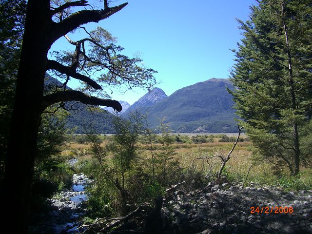
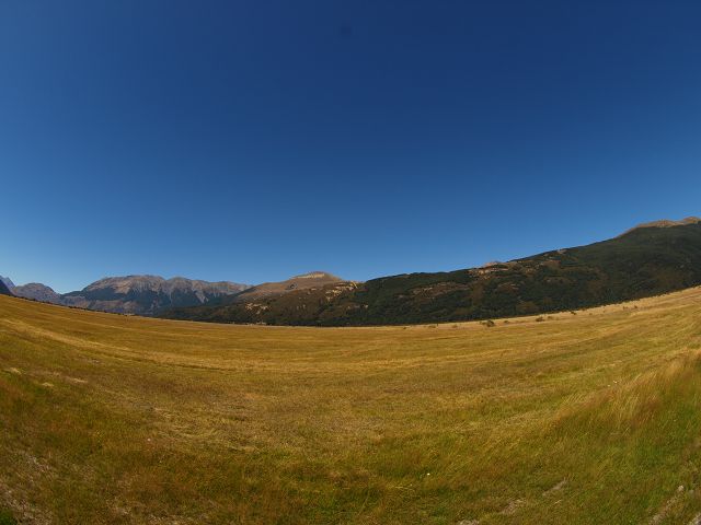
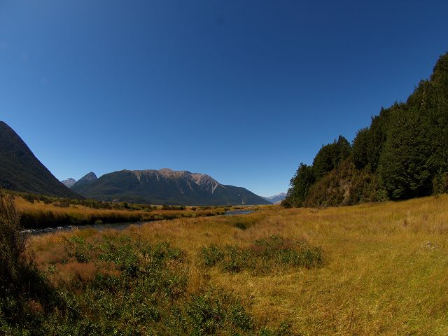
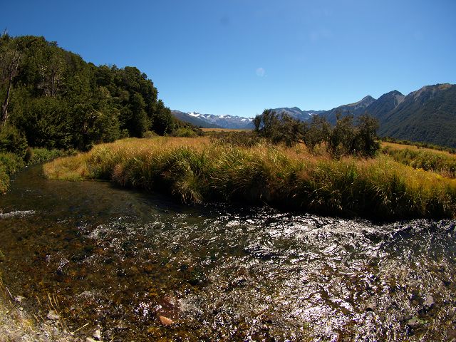
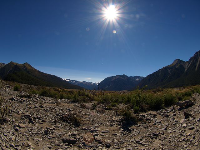
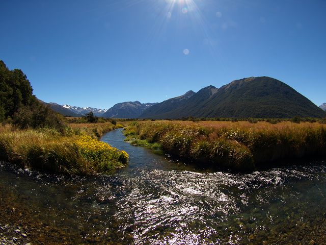
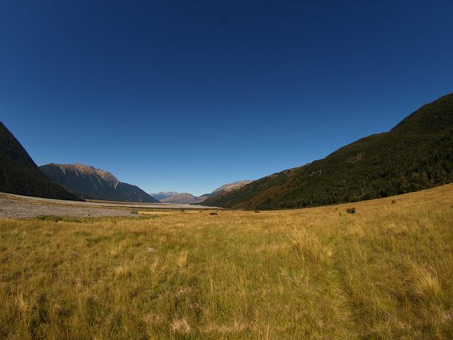
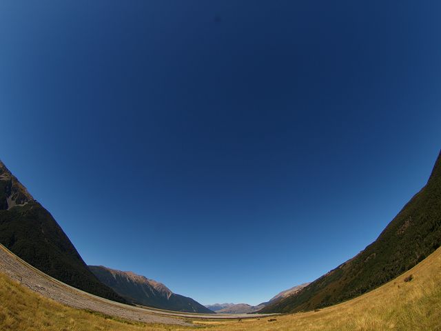
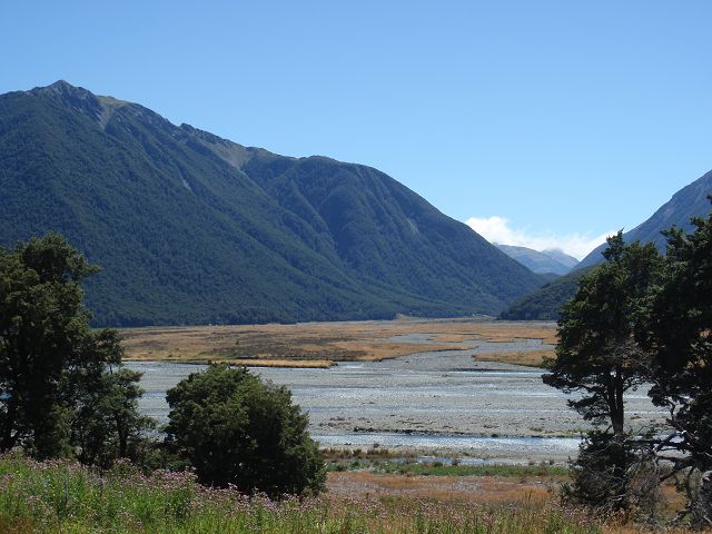
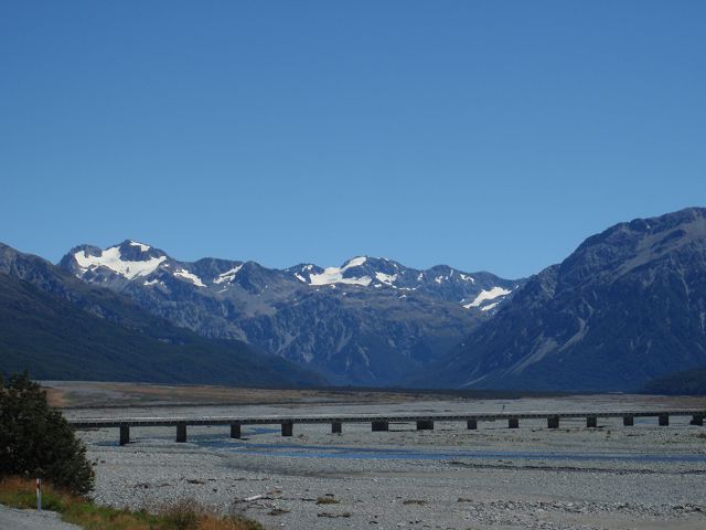
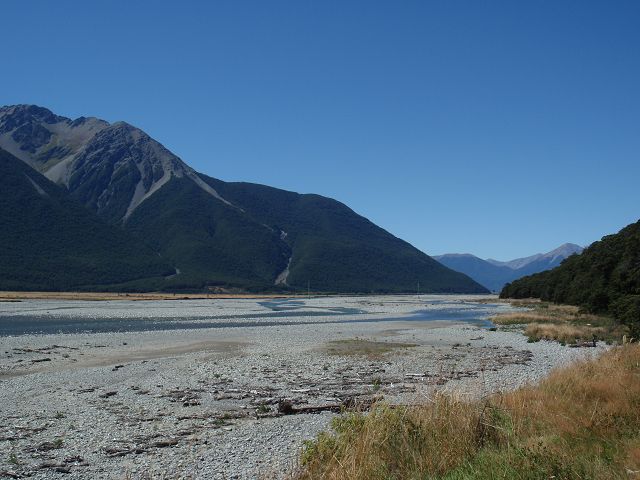
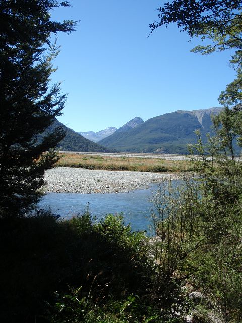
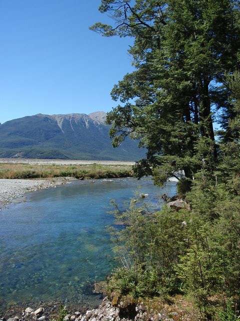
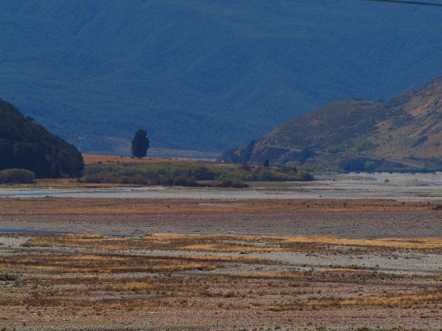
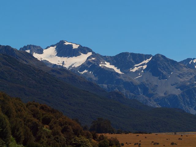
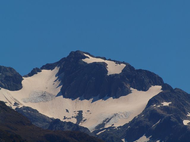
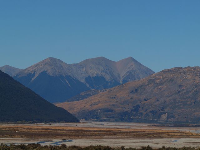
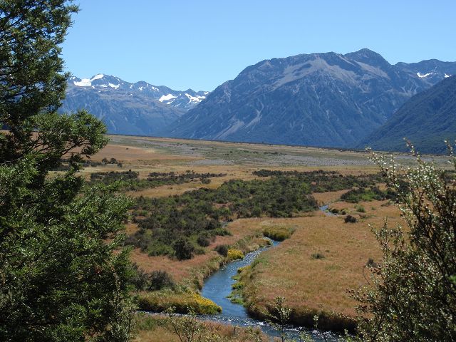
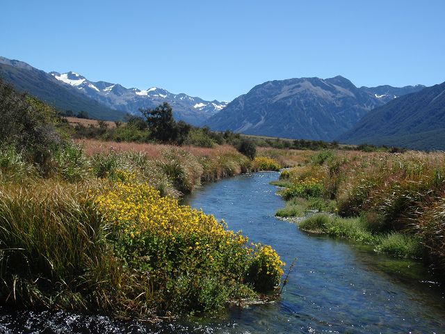
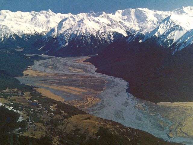
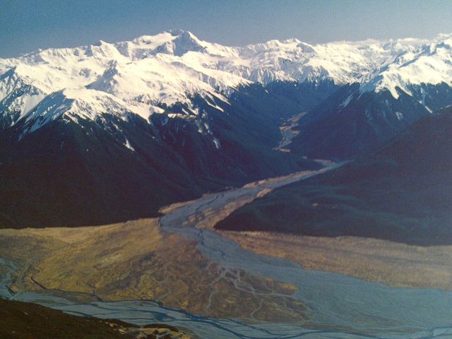
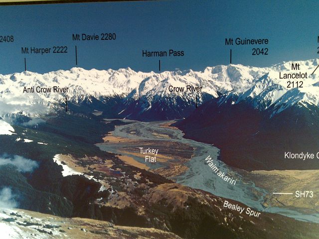
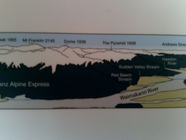
  • Southern Alps: The park is situated within the Southern Alps mountain range, which forms the backbone of New Zealand’s South Island. It offers breathtaking views of towering mountains, alpine valleys, and rivers.
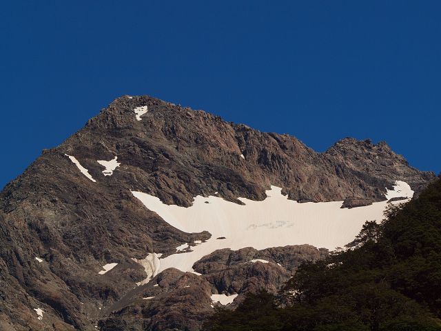
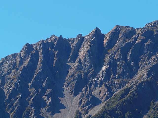
  • Alpine Terrain: Arthur's Pass is renowned for its rugged alpine terrain, with snow-capped peaks, glacial valleys, alpine meadows, and crystal-clear rivers. The park's highest point is Mount Rolleston (2,798 meters), and the park's dramatic landscapes make it a stunning location for photography and exploration.
  • Arthur's Pass Village: The park’s main access point is Arthur's Pass Village, which is located right on the Arthur’s Pass, the highest point on the Arthur's Pass Highway (State Highway 73). The village is a small settlement with basic facilities, accommodation, and a visitor center.

2. Hiking and Walking Trails

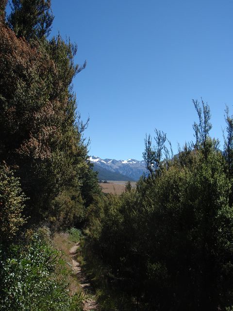
  • Arthur's Pass Track: This short, 2-hour walk is one of the easiest ways to explore the park. It offers panoramic views of the surrounding mountains, valleys, and the Bealey River. It's an ideal introduction to the park’s landscapes.
  • Avalanche Peak Track: One of the most popular and rewarding hikes in the park, the Avalanche Peak Track is a challenging 6-8 hour hike that takes you to the summit of Avalanche Peak (1,833 meters). The track offers stunning views of the Southern Alps and is known for its alpine wildflowers and dramatic scenery.
  • Temple Basin Track: This 4-hour return hike takes you to the Temple Basin Ski Field, where you can enjoy views of the surrounding mountains. The track is relatively steep and offers a great alpine experience with views of the Craigieburn Range.
  • Otira Valley Track: A more relaxed and easy walk, this 1-2 hour track follows the Otira River and leads through beautiful forested areas, providing great views of the valley and surrounding peaks.
  • Bealey Spur Track: This 2-3 hour hike follows the Bealey Spur and offers panoramic views of the Bealey Valley and the Southern Alps. It's an excellent option for those looking for a shorter walk with stunning vistas.
  • Gillespie Pass Circuit: For experienced hikers, this 4-5 day circuit provides a more challenging route through the park’s rugged terrain, with beautiful alpine landscapes and pristine wilderness.

3. Wildlife and Flora

  • Birdlife: Arthur's Pass is a haven for New Zealand's native birds. The park is home to the famous Keā, a large, inquisitive parrot that is known for its playful and cheeky behavior. The rock wren, rifleman, and fantail are also common sights. Birdwatchers can also spot the New Zealand falcon (kārearea) and South Island saddleback.
  • Alpine Flora: The park’s alpine environments are home to a variety of unique flora, including native mountain daisies, mosses, lichen, and alpine grasses. In spring and summer, the meadows are often covered in colorful wildflowers, adding to the park’s visual appeal.
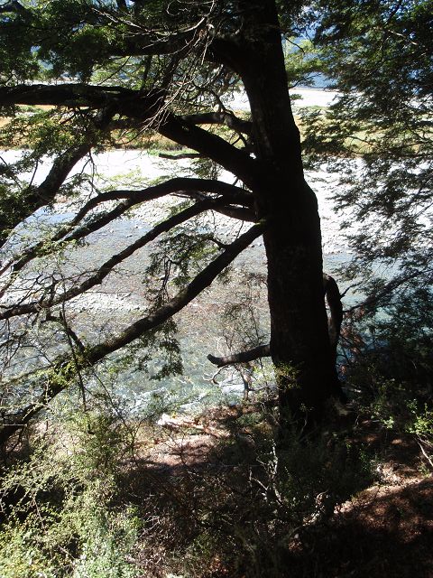
  • Beech Forests: The lower valleys of the park are covered in beech forests, which provide habitat for a wide range of birds, insects, and other wildlife. These forests are particularly lush and green, offering beautiful walking experiences in the cooler months.

4. Activities

  • Hiking and Tramping: Arthur's Pass is a hiker's paradise, with numerous tracks suitable for a variety of skill levels. The tracks vary from short, easy walks to multi-day challenging hikes, allowing visitors to fully immerse themselves in the alpine beauty of the park.
  • Mountain Biking: Some of the lower tracks in the park, such as the Waimakariri River Track, are open to mountain bikers. The tracks offer scenic views and a unique way to explore the park's wilderness areas.
  • Climbing and Mountaineering: Arthur's Pass is also a popular destination for mountaineering and rock climbing. Experienced climbers can tackle some of the park’s more difficult peaks, such as Mount Rolleston or Avalanche Peak. The park’s rugged terrain offers a variety of climbing challenges, both on rock and on ice.
  • Skiing and Snowboarding: In the winter, the nearby Temple Basin and Craigieburn Ski Field offer opportunities for skiing and snowboarding. Though the ski fields are smaller than those in other parts of New Zealand, they offer a more remote and uncrowded experience.
  • Photography: The park’s dramatic landscapes, including towering peaks, alpine lakes, and wild rivers, make it an excellent destination for landscape and nature photography.
  • Stargazing: Due to its remote location and low light pollution, Arthur’s Pass is a great place for stargazing. The park is part of the Aoraki Mackenzie International Dark Sky Reserve, and visitors can enjoy clear views of the night sky, especially during the summer months.

5. Accommodation

  • Arthur’s Pass Village: The small village at the heart of the park offers several accommodation options, including backpacker hostels, motels, cabins, and campgrounds. The Arthur’s Pass Alpine Motel is a popular choice, offering a comfortable base for exploring the park.
  • Backcountry Huts and Campsites: For those venturing on longer hikes, there are several backcountry huts and campsites located throughout the park. These are managed by the Department of Conservation (DOC) and offer a chance to immerse yourself in the natural surroundings. The Bealey Hut and Dunfeld Hut are two examples of backcountry huts that can be booked in advance.
  • Camping: There are campgrounds in and around Arthur's Pass Village, such as the Arthur's Pass Campground. The Bealey Spur Campsite offers a more remote camping experience, perfect for those who want to be closer to nature.

6. Best Time to Visit

  • Summer (December to February): Summer is the peak season for hiking, with warmer temperatures and clear skies. The alpine meadows bloom with wildflowers, making it a perfect time to explore the park's many hiking tracks.
  • Autumn (March to May): Autumn offers cooler temperatures and beautiful fall colors, with fewer tourists. The park's landscapes are stunning during this time, with the beech forests and alpine meadows turning golden and red.
  • Winter (June to August): Winter is ideal for those interested in skiing, snowboarding, or experiencing the park's quiet, snow-covered beauty. Snow can make the tracks more challenging, so it’s essential to check weather conditions before venturing out.
  • Spring (September to November): Spring is another excellent time to visit, as the snow melts and the alpine wildflowers start to bloom. The weather is variable, but the park is less crowded, allowing for a more peaceful experience.

7. Conservation and Environmental Importance

  • Protected Area: Arthur's Pass National Park is a protected area managed by the Department of Conservation (DOC). Conservation efforts focus on protecting the park's unique alpine ecosystems and its endemic species, including the endangered Keā parrot.
  • Ecological Restoration: There are ongoing ecological restoration projects aimed at preserving native plants and birdlife, such as efforts to control pest species (e.g., rats, stoats, and possums) that threaten native wildlife.

Conclusion:

Arthur's Pass National Park is a must-visit destination for nature lovers, adventurers, and hikers. With its rugged mountains, diverse ecosystems, and a wide variety of outdoor activities, it offers an authentic New Zealand wilderness experience. Whether you're tackling the challenging Avalanche Peak Track, relaxing in the Arthur's Pass Village, or enjoying the stunning alpine scenery, the park’s beauty and remoteness make it a truly unforgettable experience.

The Waimakariri River is one of the most prominent and scenic rivers in Canterbury, located on the South Island of New Zealand. It flows from the Southern Alps through the Waimakariri Basin and eventually empties into the Pacific Ocean via Pegasus Bay. The river is known for its breathtaking scenery, recreational opportunities, and vital role in the region's ecosystem and water supply.

Key Features of the Waimakariri River:

1. Geography and Flow

  • Source: The Waimakariri River originates from the Southern Alps, specifically from the Waimakariri Glacier in the Arthur's Pass National Park. The river flows west to east, passing through the Waimakariri Gorge and eventually reaching the Canterbury Plains.
  • Length: The river spans approximately 150 kilometers (93 miles) and passes through diverse landscapes, including alpine valleys, farmland, and wetlands.
  • Mouth: The river reaches the Pacific Ocean via Pegasus Bay, where it is subject to tidal influences before emptying into the sea.

2. Scenic Beauty

  • Southern Alps Backdrop: The upper stretches of the Waimakariri River are surrounded by the majestic Southern Alps, offering dramatic views of snow-capped mountains, rugged valleys, and alpine landscapes.
  • Waimakariri Gorge: This section of the river is particularly scenic, with steep cliffs and rocky gorges creating a dramatic and picturesque environment.
  • Waimakariri Basin: As the river flows eastward, it travels through the Waimakariri Basin, an area of relatively flat terrain that is used primarily for farming. Despite the agricultural development, the river's natural beauty remains a highlight of the region.
  • Pegasus Bay and Wetlands: The lower reaches of the river flow into the coastal wetlands near Pegasus Bay, providing vital habitats for a variety of bird species, including migratory shorebirds.

3. Recreation and Activities

  • Rafting and Canoeing: The Waimakariri River is popular for white-water rafting and canoeing. The river’s challenging upper sections, with rapids and fast-moving water, provide an exciting experience for adventurous paddlers. The Waimakariri Gorge is particularly famous for its thrilling rapids.
  • Fishing: The river is a prime destination for trout fishing, with rainbow and brown trout found in abundance. Anglers flock to the river's many pools and riffles, especially during the summer months when fishing conditions are ideal.
  • Jet Boating: The Waimakariri River's fast-flowing sections are also popular for jet boating, providing an exhilarating way to explore the river and its scenic surroundings.
  • Walking and Hiking: There are several walking tracks along the river, such as the Waimakariri River Track, which follows the river's course from Kowai Pass to the Shapeshifter Hill. These tracks offer hikers stunning views of the river, surrounding farmland, and mountain vistas.
  • Cycling: The Waimakariri River Trail is a popular cycling route that runs alongside the river, providing cyclists with easy access to the region’s natural beauty. The route is relatively flat and suitable for riders of all levels.

4. Environmental and Ecological Importance

  • Water Supply: The Waimakariri River is an important source of freshwater for the Canterbury region. It is used for irrigation, hydroelectric power generation, and drinking water for the surrounding areas, including the city of Christchurch.
  • Wildlife Habitat: The river and its surrounding wetlands are home to a wide range of wildlife, including native birds like the black stilt (kakī), south island pied oystercatcher, and various species of waterfowl. The river’s estuarine and coastal wetlands provide crucial habitats for migratory birds, especially in Pegasus Bay.
  • Riparian Vegetation: Along the river, the riparian zones are home to native flax (harakeke), willows, and kanuka forests, which support the region’s ecological balance and provide shelter and food for native fauna.

5. Bridges and Access Points

  • Waimakariri River Bridges: The river is crossed by several notable bridges, including the Waimakariri Gorge Bridge and the South Island Main Trunk Railway Bridge, which offer stunning views of the river below.
  • Access from Christchurch: The Waimakariri River is easily accessible from the city of Christchurch, making it a popular spot for day trips and outdoor activities. The river is just a short drive from the city, with many tracks and access points along its length.

6. Flooding and Management

  • Flood Control: The Waimakariri River has historically been prone to flooding, especially during heavy rains in the winter months. The Canterbury region has implemented various flood management systems, including dams and river diversions, to protect farmland and urban areas from flooding.
  • Waimakariri River Management: The river is carefully managed by local authorities to balance environmental concerns, flood protection, and recreational uses. Canterbury Regional Council and other organizations monitor the river’s flow and implement conservation practices to protect the surrounding ecosystems.

7. Best Time to Visit

  • Summer (December to February): Summer is the best time for river activities like rafting, fishing, and jet boating, as the water levels are ideal, and the weather is warm. The Waimakariri River also offers excellent hiking and biking conditions during this season.
  • Autumn (March to May): The fall season brings cooler temperatures and beautiful foliage along the riverbanks, providing a peaceful and scenic time to explore the river by foot or bike.
  • Winter (June to August): The winter months can bring cold temperatures and occasional snow to the region, which may impact some activities. However, the snow-capped peaks of the Southern Alps make for a stunning winter landscape, and it's a quieter time to visit the area.
  • Spring (September to November): Spring is a great time to visit for birdwatching and wildlife photography, as migratory birds begin to arrive in the wetlands. The riverbanks also come alive with native plants and flowers.

Conclusion:

The Waimakariri River is a stunning and versatile destination in New Zealand's Canterbury region, offering a wide range of outdoor activities, including rafting, fishing, hiking, and birdwatching. Its rugged landscapes, beautiful views of the Southern Alps, and ecological significance make it an important feature of the region. Whether you’re seeking an adrenaline-pumping adventure on the water or a peaceful walk along the riverbanks, the Waimakariri River is sure to provide a memorable experience.


12.03.25 Copyright   Dirk  Rauschenbach Koelnerstrasse 293 51702 Bergneustadt  Datenschutzerklaerung   02261 9788972  Mail ccooly( at) web.de