 Safaris
Bergsteigen
Wandern
Inselwandern Weltweit
Safaris
Bergsteigen
Wandern
Inselwandern Weltweit
 Chronologie
Inselwandern
Chronologie
Inselwandern Europa
Inselwandern
Europa
Inselwandern
 Städtewandern
 Paintings
 Dirk Rauschenbach
|
Safaris
Bergsteigen
Wandern
Inselwandern Weltweit
|
Chronologie
Inselwandern |
Europa
Inselwandern
|
Städtewandern
|
Paintings |
Dirk Rauschenbach
|
|
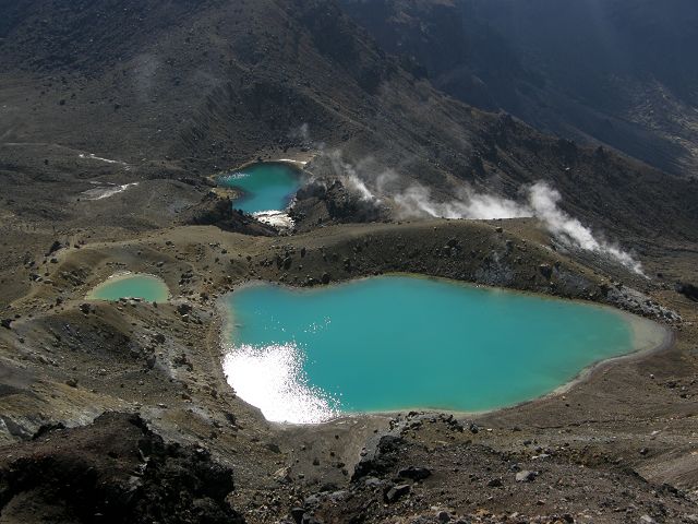
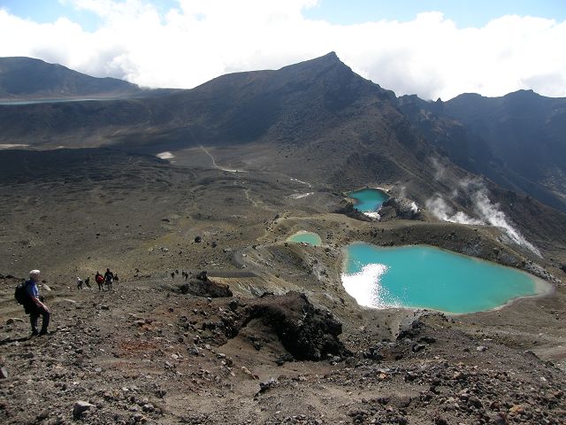
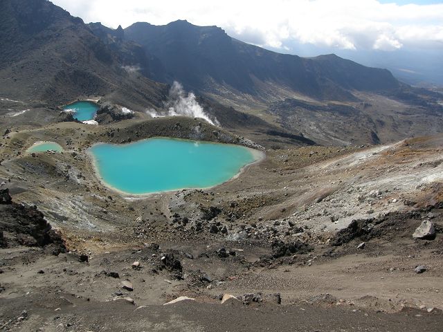
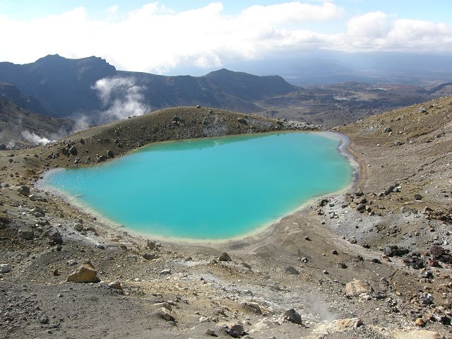
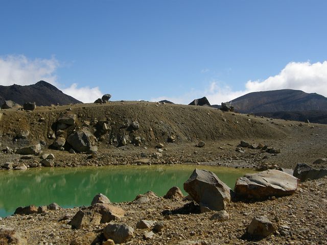
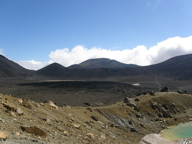
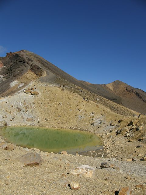
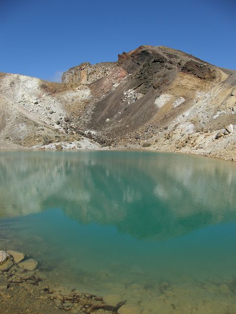
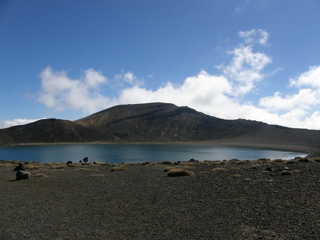
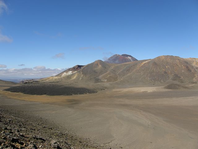
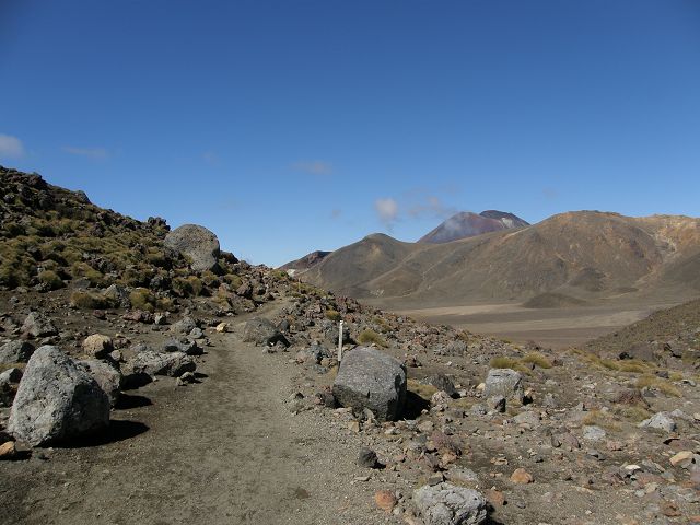
back Tongariro zurück Neuseeland back New Zealand Tongariro Crossing Emerald Lakes New Zealand Tongariro Crossing
 |
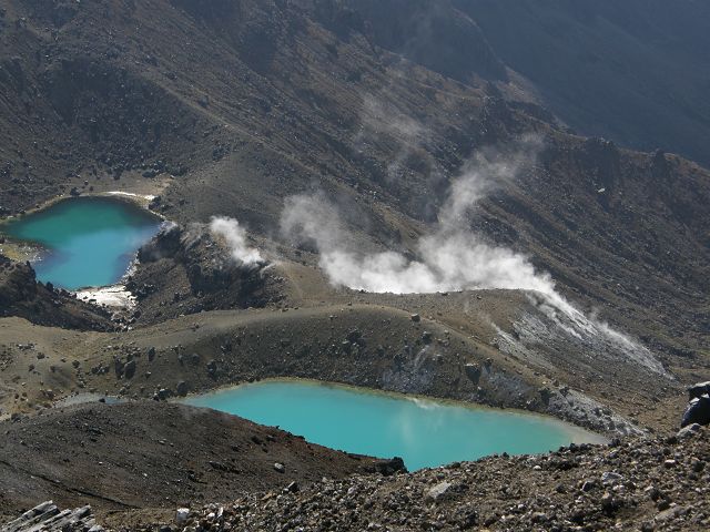 |
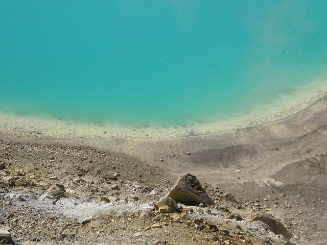
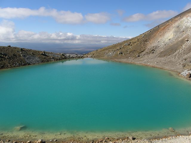
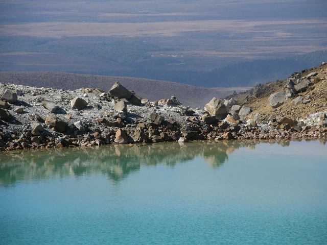
| Emerald Lakes Tongariro Crossing | Emerald Lakes Tongariro Crossing |
 |
 |
| Emerald Lake Tongariro Crossing | steiler Alpiner Abstieg zu den Emerald Lakes |
 |
 |
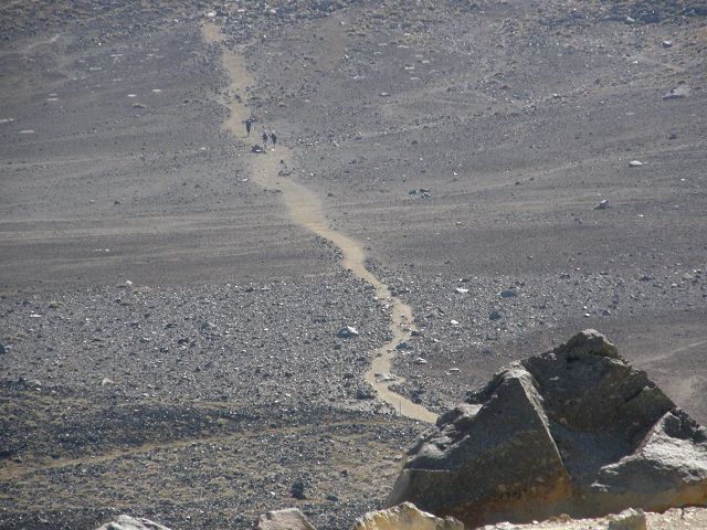
| Emerald Lakes | steiler Absteig oder andersrum steiler Aufstieg |
 |
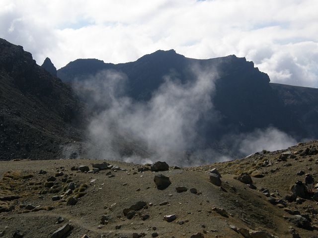 |
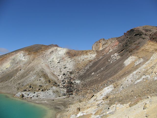
| Schwelfelquelle Sulphur springs | |
 |
 |
 |
 |
 |
 |
 |
 |
 |
 |
 |
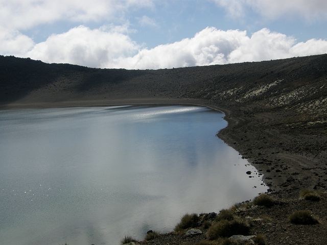 |
| Blue Lake | Blue Lake |
 |
 |
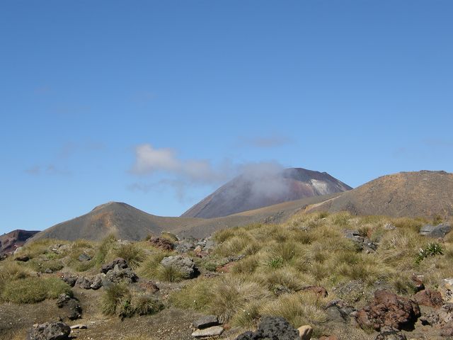 |
Tongariro Crossing
The Emerald Lakes are one of the most iconic features along the Tongariro Alpine Crossing in Tongariro National Park on New Zealand's North Island. These stunning lakes are located near the highest point of the crossing, at the base of the Red Crater, and are famous for their striking vibrant green color. Key Features of the Emerald Lakes:
|
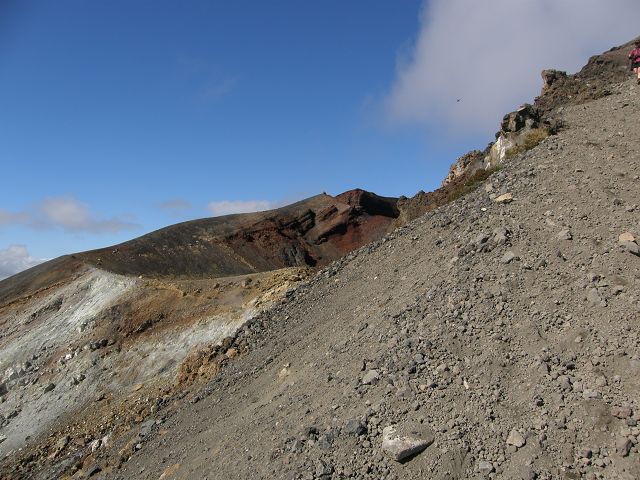
| Beginn des Abstiegs | |
| Die Tongariro Alpine Crossing ist eine der
bekanntesten und spektakulärsten Tageswanderungen Neuseelands und gilt als
eine der besten Wanderungen der Welt. Sie führt durch das Herz des Tongariro
National Park, des ältesten Nationalparks Neuseelands und eines
UNESCO-Weltkulturerbes. Die Wanderung bietet atemberaubende vulkanische
Landschaften, farbenfrohe Kraterseen und spektakuläre Aussichten auf die
umliegenden Berge. Highlights der Tongariro Alpine Crossing: Vulkanische Landschaft: Die Wanderung führt durch eine dramatische vulkanische Landschaft, die von den Vulkanen Mount Tongariro und Mount Ngauruhoe (auch bekannt als Mount Doom aus „Der Herr der Ringe“) geprägt ist. Emerald Lakes: Die smaragdgrünen Seen sind eines der bekanntesten Highlights der Wanderung. Ihre intensive Farbe entsteht durch mineralische Ablagerungen aus den umliegenden Thermalquellen. Red Crater: Der Red Crater ist ein beeindruckender vulkanischer Krater, der durch seine rote Färbung und seine steilen Wände besticht. Von hier aus hat man einen spektakulären Blick auf die Emerald Lakes und die umliegende Landschaft. Mount Ngauruhoe: Der ikonische Vulkan ist ein markantes Wahrzeichen der Wanderung. Er ist bekannt als „Mount Doom“ aus den Filmen „Der Herr der Ringe“. Ketetahi Hut: Die Ketetahi Hut ist eine Raststation auf der Wanderung und bietet einen guten Ort, um sich auszuruhen und die Aussicht zu genießen. Aussichtspunkte: Die Wanderung bietet zahlreiche Aussichtspunkte, von denen aus man die umliegenden Berge, Täler und Seen bewundern kann. Informationen zur Wanderung: Länge: 19,4 Kilometer (einfache Strecke) Dauer: 6–8 Stunden (abhängig von der Fitness und den Wetterbedingungen) Schwierigkeitsgrad: Mittel bis anspruchsvoll Höhenunterschied: Der höchste Punkt der Wanderung ist der Red Crater auf 1.886 Metern. Vorbereitung und Tipps: Wetter: Das Wetter in den neuseeländischen Alpen kann schnell wechseln. Es ist wichtig, wetterfeste Kleidung, Sonnenschutz und ausreichend Wasser mitzunehmen. Überprüfe die Wettervorhersage vor der Wanderung und sei auf alle Bedingungen vorbereitet. Ausrüstung: Gutes Schuhwerk, warme Kleidung, Regenjacke, Sonnencreme, Hut, ausreichend Wasser und Snacks sind unerlässlich. Ein Wanderstock kann hilfreich sein, besonders beim Abstieg. Transport: Die Wanderung ist eine Streckenwanderung, daher ist es notwendig, den Transport vom Ende der Wanderung zurück zum Ausgangspunkt zu organisieren. Es gibt Shuttlebusse, die diesen Service anbieten. Fitness: Die Wanderung ist anspruchsvoll und erfordert eine gute körperliche Fitness. Es ist wichtig, sich vorher ausreichend vorzubereiten. Respektiere die Natur: Halte die Wanderwege sauber und respektiere die Umwelt. Nimm deinen Müll mit und störe die Tierwelt nicht. Beste Zeit für die Wanderung: Saison: Die beste Zeit für die Tongariro Alpine Crossing ist von November bis April, wenn das Wetter stabiler ist und die Wanderwege in gutem Zustand sind. Winter: Im Winter kann die Wanderung aufgrund von Schnee und Eis gefährlich sein und erfordert spezielle Ausrüstung und Erfahrung. Warum die Tongariro Alpine Crossing wandern? Die Tongariro Alpine Crossing ist ein unvergessliches Erlebnis, das die dramatische Schönheit der neuseeländischen Vulkanlandschaft in ihrer ganzen Pracht zeigt. Mit ihren farbenfrohen Seen, steilen Kratern und spektakulären Aussichten ist die Wanderung ein Muss für jeden Naturliebhaber und Abenteurer. Sie bietet eine einzigartige Gelegenheit, die atemberaubende Landschaft des Tongariro National Park zu erleben und die Kraft der Natur zu spüren. |
The Tongariro Crossing is one of New Zealand's most famous and challenging one-day hikes, located in the Tongariro National Park on the North Island. It offers breathtaking views of volcanic landscapes, crater lakes, and diverse ecosystems, making it a must-do trek for many outdoor enthusiasts. Here's all you need to know about the Tongariro Crossing: Overview:
Location:
Key Highlights of the Tongariro Crossing:
Best Time to Do the Crossing:
Important Tips:
Conservation and Environmental Responsibility:
Conclusion:The Tongariro Crossing is one of the best day hikes in New Zealand, offering dramatic views, fascinating volcanic features, and a sense of adventure. Whether you're a nature lover, a photography enthusiast, or a Lord of the Rings fan, the crossing is an unforgettable experience! |
![]() 05.06.26 Copyright Dirk
Rauschenbach Koelnerstrasse 293 51702 Bergneustadt
Datenschutzerklaerung 02261 94417 oder
Handy oder Mail ccooly(
at) web.de
05.06.26 Copyright Dirk
Rauschenbach Koelnerstrasse 293 51702 Bergneustadt
Datenschutzerklaerung 02261 94417 oder
Handy oder Mail ccooly(
at) web.de