zurück Peru
Back Panamericana Nascaoverwiew
Panamericana (englisch Pan-American Highway,
spanisch Carretera Panamericana
Panamericana verläuft auf zwei Wegen in
Peru n.Chile
 |
 |
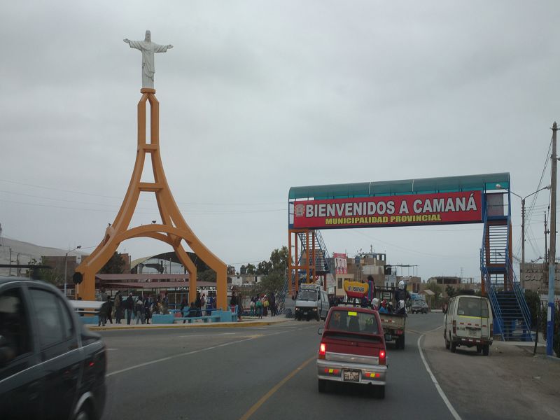
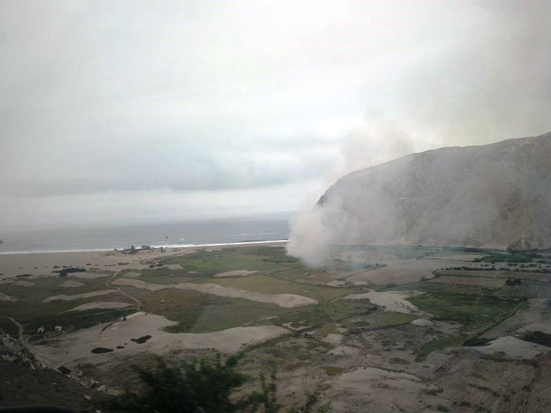
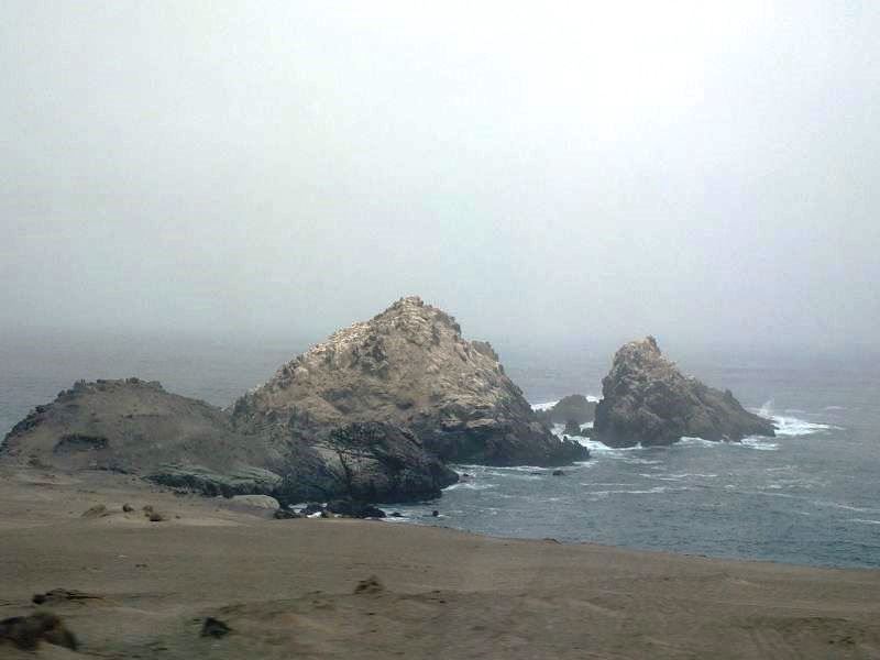
Panamericana Peru Camana |
Panamericana Peru |
 |
 |
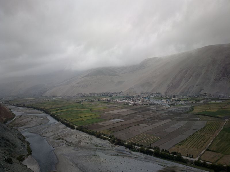
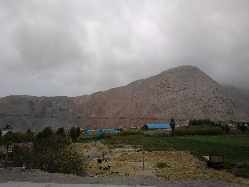
Panamericana Peru fruchtbares Tal |
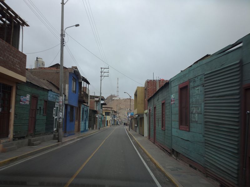
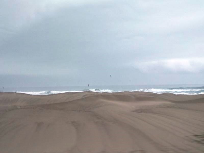
Panamericana Peru
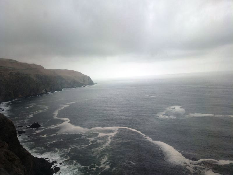
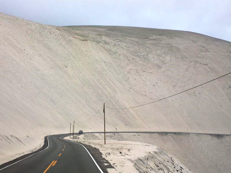
unendliche Küstenstrasse |
 |
 |
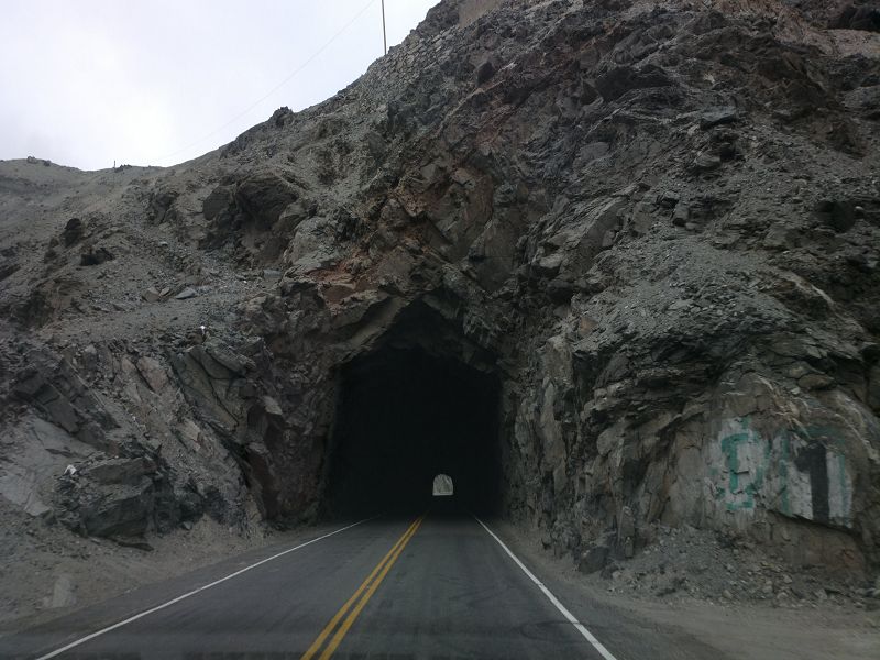
Panamericana Peru Tunnel mit Überraschungen |
Panamericana Peru
Fischfabrik |
 |
 |
Panamericana Peru |
Panamericana Peru |
 |
 |
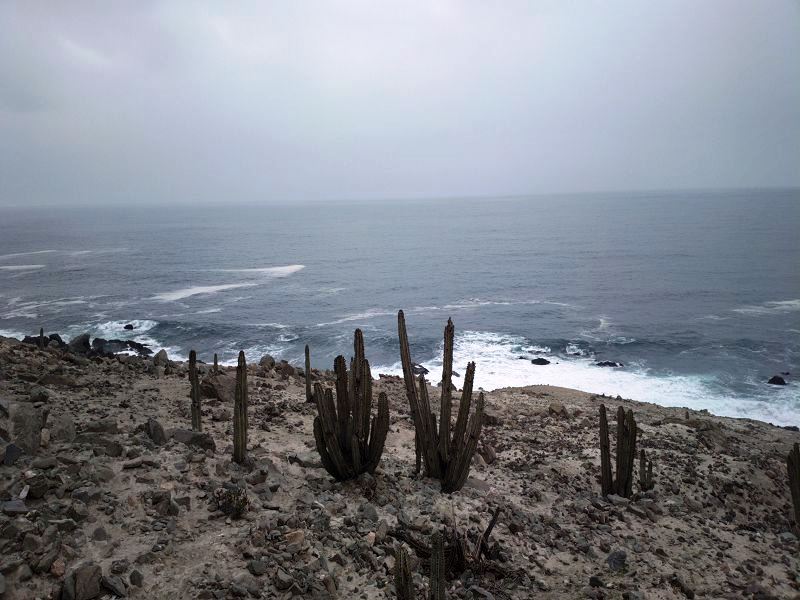
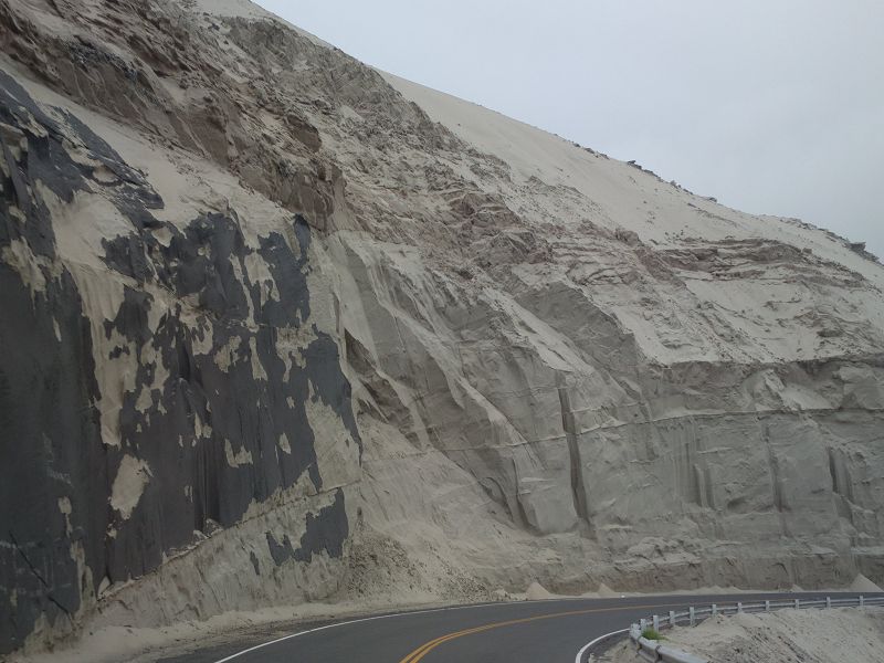
Panamericana Peru Küstenklima gut für Kakteen |
Panamericana Peru |
 |
 |
Panamericana Peru |
Panamericana Peru
#pan-american #highway #spanisch #carretera #panamericana #car #germany
#mercedesamg #deutsch #road #mercedesbenz #street #deutschland #urbanart
#amg #drive #essen #truck #mbfanphoto #cars #spanish #bmw #mercedes
#speed #lecker #stickers #affalterbach #sportscar #español #transport |
Pan-American Highway
The
Panamericana Highway (also
known as the Pan-American Highway)
is a network of roads
that stretches across the entire
Americas, from Alaska
in the United States to
Ushuaia in
Argentina. It is one of
the longest continuous road systems in the world, connecting
North America,
Central America, and
South America.
Key Facts about the
Panamericana Highway:
-
Length and Scope:
- The total length of the
Pan-American Highway
is about 19,000 miles
(30,000 kilometers), making it the longest road network
in the world.
- It passes through
14 countries in
North, Central, and South America, including the United States,
Canada, Mexico, Guatemala, El Salvador, Honduras, Nicaragua,
Costa Rica, Panama, Colombia, Ecuador, Peru, Chile, and
Argentina.
-
Route:
- The highway runs along the
western edge of the
Americas, following a path along the
Pacific Ocean.
- In the
United States,
the highway is often referred to as
Interstate 5
(I-5), which runs from
San Diego, California up to
Vancouver, Canada.
- From
Panama to
Colombia, the
highway temporarily stops, due to the
Darien Gap,
an impassable stretch of about
100 miles (160 km)
of jungle, swamps, and marshes between the two countries. This
gap is one of the few interruptions in the highway, and
travelers must use alternative means (boats or air transport) to
cross it.
-
Countries and Regions:
-
North America:
The route begins in
Alaska, USA, and moves south through
Canada,
Mexico, and
the Central American countries.
-
Central America:
It passes through
Guatemala, El
Salvador,
Honduras,
Nicaragua,
Costa Rica, and
Panama.
-
South America:
After Panama, the highway continues through
Colombia,
Ecuador,
Peru,
Chile, and
ends in
Argentina.
- The highway connects a
variety of landscapes, including deserts, mountains, forests,
and coastal areas, offering travelers stunning views and diverse
ecosystems.
-
Notable Segments:
-
In the United States:
The highway follows the
Pacific Coast,
passing through California’s iconic coastal towns, the
San Francisco Bay Area,
and then continuing north.
-
The Darien Gap:
As mentioned earlier, the
Darien Gap
between Panama and Colombia is a major interruption in the
highway, where no road infrastructure exists. Travelers must
bypass this section using boats or small aircraft.
-
Peru: In
Peru, the
Panamericana Sur
(South Pan-American Highway) runs from
Lima to
Ica, and
continues along the
coastal desert, offering access to some of Peru’s most
famous landmarks, including the
Nazca Lines
and the Paracas
National Reserve.
-
Chile: The
highway runs through the
Atacama Desert,
one of the driest places on Earth, and offers access to the
coast as well as mountainous terrain.
-
Cultural and Scenic
Importance:
- The Pan-American Highway
offers travelers a unique cross-section of the Americas. As it
cuts through multiple regions and countries, it provides
opportunities to experience various
cultures,
languages,
and environments.
-
Nature enthusiasts
can witness landscapes ranging from
rainforests
in Central America,
to high-altitude
plateaus in the
Andes, to
desert landscapes in the
Atacama Desert.
-
Tourism and Travel:
- The Pan-American Highway
is a dream for road
trip enthusiasts. Many people attempt the
"Pan-American road
trip", driving from the northernmost point in Alaska
down to the southernmost point in Argentina. This journey takes
months or even years to complete, depending on the route and the
stops along the way.
- Various travel agencies
offer guided tours
along sections of the highway, particularly through countries
like Peru and
Chile, where
tourists can see key historical and natural attractions.
-
Challenges:
-
Infrastructure:
While the highway is well-developed in many areas, some parts of
it, especially in Central America and parts of South America,
may be less paved or less maintained.
-
Safety: In
some regions, there may be
safety concerns
due to political instability, road conditions, or remote areas.
It’s important to research thoroughly and plan for safety,
especially if driving alone.
-
Famous Stops Along the
Panamericana:
-
Machu Picchu
(Peru): The historic
Inca city in the Andes is a key attraction for
travelers on the highway.
-
Nazca Lines
(Peru): Ancient geoglyphs visible from the air, near the
Panamericana Sur.
-
Iquique
(Chile): A coastal city known for its
beaches and
salt flats.
-
Los Glaciares National
Park (Argentina): Known for
Perito Moreno Glacier
and dramatic mountain landscapes.
Summary:
The
Panamericana Highway
is a remarkable, nearly
19,000-mile long network of roads that stretches from
Alaska to
Argentina, passing
through a diverse array of landscapes and cultures. Although it’s
interrupted by the Darien Gap,
the highway offers some of the most scenic and adventurous road trips in
the world, making it a must-experience for
travelers and
road trip enthusiasts.
|
|
|
|
02.03.25 Copyright Dirk
Rauschenbach Koelnerstrasse 293 51702 Bergneustadt
Datenschutzerklaerung 02261 9788972 Mail ccooly(
at) web.de