 Safaris
Bergsteigen
Wandern
Inselwandern Weltweit
Safaris
Bergsteigen
Wandern
Inselwandern Weltweit
 Chronologie
Inselwandern
Chronologie
Inselwandern Europa
Inselwandern
Europa
Inselwandern
 Städtewandern
 Paintings
 Dirk Rauschenbach
|
Safaris
Bergsteigen
Wandern
Inselwandern Weltweit
|
Chronologie
Inselwandern |
Europa
Inselwandern
|
Städtewandern
|
Paintings |
Dirk Rauschenbach
|
|
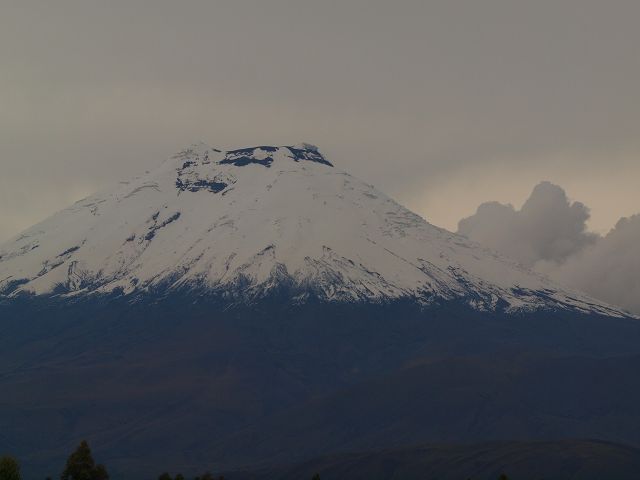
zurück Ecuador back Cotopaxi Cotopaxi Vulkan Cotopaxi Vulcano Ecuador
 |
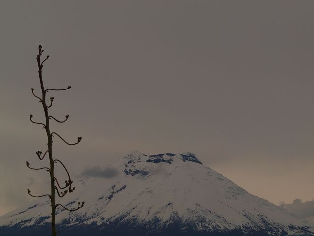 |
| Cotopaxi 5.897 m der zweithöchster Berg Ecuadors | Anfahrt von Machachi Parque National de Cotopaxi Cotopaxi Nationalpark ca. 350 km² groß. |
 |
 |
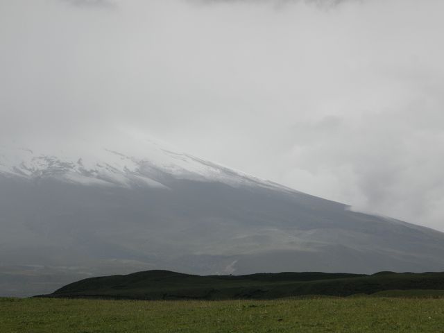
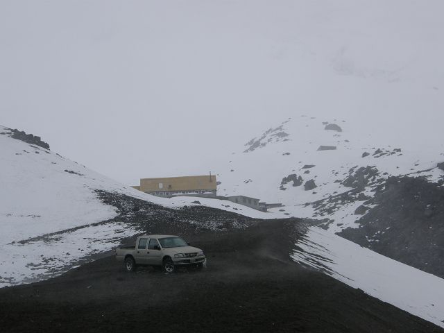
| Cotopaxi Parkplatz | Cotopaxi Paramo |
 |
|
| Cotopaxi Laguna Limpiopungo Limpiopungo Lagune | Wildpferde auf der Cotopaxi Hochebene |
| It seems you might be referring to Isabela
Island (Spanish: Isla Isabela), the largest island in the Galápagos
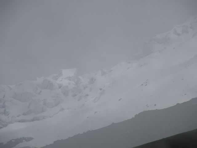
Archipelago, part of Ecuador. Here’s a summary of key details about it: Key Facts About Isabela Island (Galápagos) Size & Geography: Largest island in the Galápagos, covering 4,586 km² (larger than all other islands combined) 1. Formed by six shield volcanoes, five of which are still active (e.g., Volcán Wolf, the highest point at 1,707 m) 1. Wildlife: Home to giant tortoises (with distinct subspecies due to geographic isolation), marine iguanas, penguins, and Galápagos hawks 1. The Bolivar Channel on the west coast is a prime spot for whale and dolphin watching 1. Human Presence: Population: ~1,748 inhabitants, with Puerto Villamil as the main settlement 1. Historic sites include the Wall of Tears, built by prisoners in a former penal colony 1. Unique Features: Straddles the equator, with volcanic landscapes like Urbina Bay (uplifted coral reefs) and Tagus Cove (tuff cones) 1. If you meant another island (e.g., Isla Ángel de la Guarda in Mexico), note that it’s uninhabited and part of the Gulf of California 2. Clarify if you need details on a different location! For more, see Isabela Island’s Wikipedia page 1. Cotopaxi Here’s a detailed overview of Cotopaxi, one of Ecuador’s most iconic and active volcanoes: 1. Overview & Key Facts Location: Andes Mountains, Ecuador, about 50 km south of Quito 28. Elevation: 5,897 meters (19,347 ft), making it the second-highest peak in Ecuador after Chimborazo 28. Type: Active stratovolcano (composite volcano) with a near-perfect symmetrical cone 16. Glacier: One of the few equatorial glaciers, starting at 5,000 m 24. Crater: 800 × 550 m wide and 250 m deep, with nested rims 24. 2. Volcanic Activity Eruptions: Over 87 recorded eruptions since 1534, with major events in 1744, 1768, and 1877 causing devastating lahars (mudflows) that reached the Pacific Ocean and Amazon Basin 27. Recent Activity: 2015–2016: Phreatic explosions, ash plumes, and pyroclastic flows 7. 2022–2023: New eruption began in October 2022, with frequent ash emissions and minor lahars 7. Risks: High threat due to lahars from melted glaciers, endangering nearby valleys and cities like Latacunga 27. 3. Climbing & Tourism First Ascent: German geologist Wilhelm Reiss and Colombian Ángel Escobar in 1872 28. Popular Route: North side (Grade PD-), requiring crampons, ice axes, and acclimatization. The José F. Ribas Refuge (4,864 m) serves as a base camp 26. Challenges: Altitude sickness, crevasses, and steep ice slopes (up to 50°). Only ~50% of climbers reach the summit 49. Alternative Activities: Hiking: Laguna Limpiopungo trail (2.6 km loop) for views of Cotopaxi 4. Mountain Biking: Thrilling descents from the refuge 9. Horseback Riding: Explore the national park’s grasslands 10. 4. Cotopaxi National Park Size: 333.9 km², protecting the volcano and ecosystems like páramo grasslands 48. Wildlife: Andean foxes, deer, and migratory birds 4. Access: Via the Pan-American Highway, the world’s longest road 810. 5. Cultural & Historical Significance Name Origin: Quechua "Coto" (neck/throat) + "Paxi" (moon), referring to its crater’s crescent shape 26. Mythology: In indigenous legends, Cotopaxi is a flirtatious woman pursued by Chimborazo 610. UNESCO Recognition: Part of the Andes’ volcanic chain and the Pacific Ring of Fire 810. Safety & Visiting Tips Best Time: November–February (stable weather) 69. Preparation: Acclimatize for 2–3 days, pack thermal layers, and hire certified guides for summits 910. Monitoring: Closely watched by Ecuador’s Geophysical Institute for eruption signs 79. For more, explore Cotopaxi National Park or eruption updates from IG-EPN. |
Cotopaxi is one of the most famous and active volcanoes in Ecuador. It's located in the central part of the country, part of the Andes mountain range, and is the second-highest active volcano in the world, standing at 5,897 meters (19,347 feet) above sea level. Cotopaxi is well-known for its almost perfect symmetrical cone shape, which makes it an iconic sight. It's a popular destination for climbers and adventurers, offering both a challenging ascent and breathtaking views. The volcano is part of Cotopaxi National Park, which is home to a variety of wildlife, including llamas, Andean foxes, and several bird species, like condors. The volcano erupted as recently as 2015, though its activity has been closely monitored, and it's still considered an active volcano. Is there a particular aspect of Cotopaxi you're interested in? The park, the climbing experience, or maybe the history of its eruptions? Let me know! |
| Rumiñahui 4721 m |
![]() 05.06.26 Copyright Dirk
Rauschenbach Koelnerstrasse 293 51702 Bergneustadt
Datenschutzerklaerung 02261 94417 oder
Handy oder Mail ccooly(
at) web.de
05.06.26 Copyright Dirk
Rauschenbach Koelnerstrasse 293 51702 Bergneustadt
Datenschutzerklaerung 02261 94417 oder
Handy oder Mail ccooly(
at) web.de